When will rain turn to snow during a nor’easter?
Rain can turn to snow when the melting layer becomes too shallow or cool to melt flakes completely on their way down. The air just above the ground is one part of that profile.
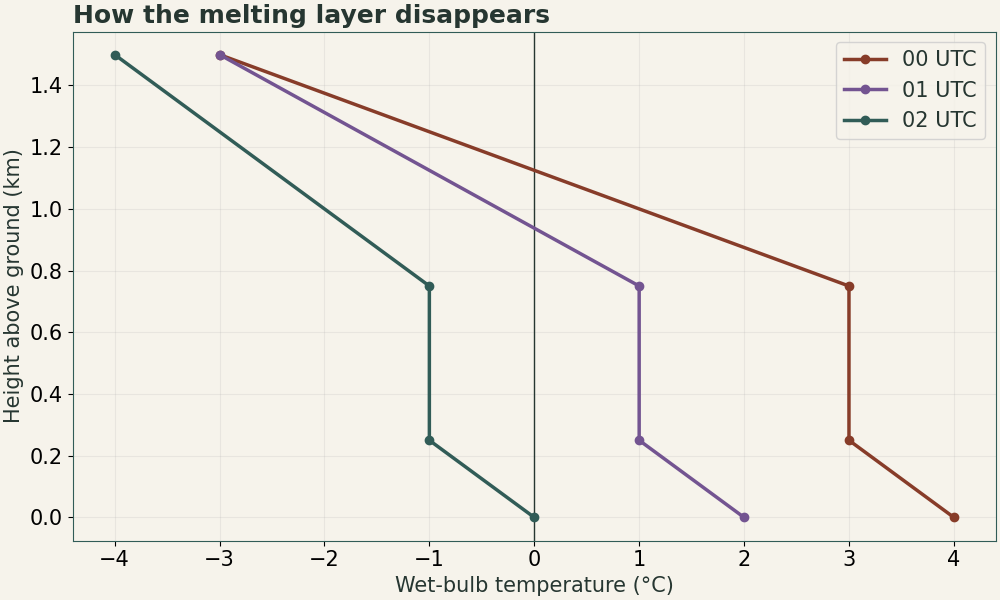
| Height AGL | 00 UTC | 01 UTC | 02 UTC |
|---|---|---|---|
| 1,500 m | −3°C | −3°C | −4°C |
| 750 m | +3°C | +1°C | −1°C |
| 250 m | +3°C | +1°C | −1°C |
| Surface | +4°C | +2°C | 0°C |
How it works
Start with forecast wet-bulb temperatures by height. A persistent warm layer aloft can melt snow even when the surface is near freezing. As colder air arrives, or evaporation and melting cool the layer, the warm area may shrink enough for flakes to survive. A shallow subfreezing layer below a warm nose can produce freezing rain or ice pellets in other setups. Check precipitation reports to see whether the expected changeover is actually occurring.
What changeover does this synthetic wet-bulb sequence suggest?
At 00 UTC a deep warm layer favors rain. At 01 UTC the warmer layer has weakened and a mix can be possible. By 02 UTC the sampled profile supports snow reaching the ground. In EST the samples span 7 to 9 p.m. on the preceding date. Closely spaced observations and radar may refine the timing.